


Alright, let’s get into it!
What is Carto?
Carto introduced SaaS platforms for GIS, marking a major milestone in the industry. Their approach has been aimed at simplifying map creation for a broader audience, including those who are not GIS experts. Carto offers an interface that is designed to be visually appealing. In recent years, they have shifted their focus towards data analysts, database experts, and developers interested in location intelligence and data visualization. Advanced users can utilize database connections and customizations to conduct more complex data analysis and create visually appealing visualizations using Carto’s online maps.
What is CartoVista?
is a powerful cloud-based mapping platform designed for creating online and interactive story maps. With a strong emphasis on user-friendliness, CartoVista is dedicated to democratizing map crafting and data analysis, making it accessible to individuals beyond the realm of GIS specialists, data analysts, or developers. The platform combines a seamless user experience with visually stunning aesthetics and rich features, including story mapping, live data updates, online editing, and task automation via a rich REST API. Harnessing the power of the cloud and offering an affordable entry price, CartoVista empowers users to tell captivating stories with their data and make informed decisions.
Head-to-head comparison
| Key Considerations | Carto | CartoVista |
| Ease of use | ||
| Data integration and analysis | ||
| Mapping and visualization capabilities | ||
| Storytelling capabilities | ||
| Collaboration and sharing | ||
| Pricing and licensing |
Where Each Platform Shines
Carto
Carto is a SaaS platform for online maps that shines when it comes to location intelligence and data visualization. While it offers basic mapping features for non-developers who prefer a user-friendly interface, the platform’s true strength emerges when utilized by developers or data scientists who can connect extensive datasets and customize maps using code. Carto relies on databases and SQL queries to facilitate advanced data visualization and analysis. The platform also features a modern interface with appealing color schemes, enhancing the visual aspect of their maps.
CartoVista
also focuses on data visualization but makes it available for every user, even if they are not a developer. The platform eliminates the necessity for coding skills to leverage its advanced features, allowing every user to fully customize map layers and enhance the overall map-viewing experience. While GIS professionals and developers can appreciate the user-friendly nature and accessibility of CartoVista, its standout feature lies in its integrated storytelling and presentation capabilities. These features seamlessly integrate with advanced data visualization options and query tools, setting CartoVista apart from the competition.
Ease of use
Carto
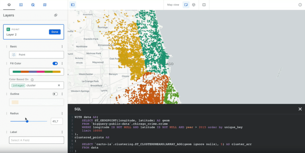
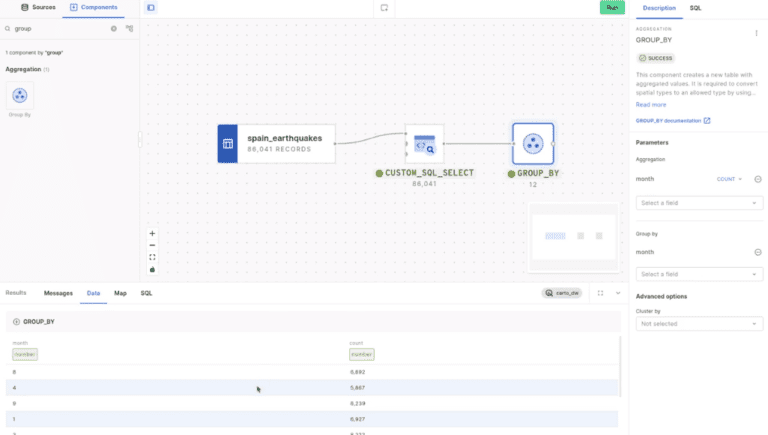
Carto offers a simplified experience for non-developers to create simple online maps and conduct data analysis. Nevertheless, to unlock more advanced features and take maps to a higher level, users must delve into the code. For each map or widget, there’s an option to switch to “code mode” for access to these advanced capabilities, indicating a developer-oriented approach. Additionally, connecting to external cloud databases necessitates advanced SQL knowledge for database administration. Carto also relies heavily on SQL to perform advanced spatial analysis.
CartoVista
CartoVista offers an intuitive and user-friendly interface, meticulously designed to ensure ease of use. With its simple drag-and-drop functionality, users can effortlessly create interactive story maps without the need for extensive GIS experience. One of the platform’s standout features is its quick and easy learning curve, allowing even those unfamiliar with complex mapping tools to dive in and start crafting captivating visual narratives. The in-app tutorial guides users through the basic steps of map creation. Whether you’re a seasoned GIS professional or a novice explorer, Cartovista provides a seamless and accessible experience for all.
Data integration and analysis
Carto
Carto is recognized for its cloud data integration capabilities, catering to data analysts and developers. It allows users to connect to external cloud databases such as Google BigQuery, Snowflake, Amazon Redshift, and Databricks. Once connected, the data is not stored in Carto to avoid duplication. Carto has specialized in the integration of large datasets and has options to optimize them. Additionally, Carto provides access to a library of free public datasets. The platform also features advanced analytics functionalities, including a built-in ETL-like tool for creating data pipelines. However, utilizing these features requires advanced knowledge of database management and analysis.
CartoVista
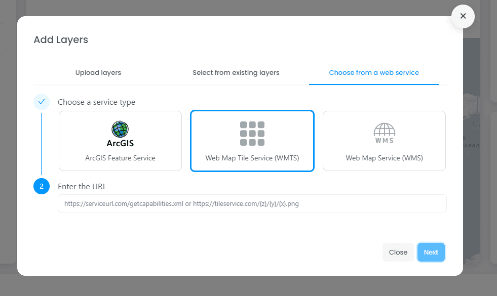
On the other hand, CartoVista offers flexible data integration options, allowing you to easily drag and drop your data, or connect to various data sources through online services. It supports popular file formats such as CSV, Excel, GeoJSON, and more, enabling you to import and manage spatial data effectively. Standard web services such as WMS, WMTS, or ArcGIS Feature services are supported to ensure compatibility with existing sources of data.
CartoVista also provides APIs for custom integrations, enabling seamless connectivity with data systems. Another feature is that CartoVista stores data internally, ensuring swift delivery and maintaining a secure cloud environment.
Mapping and visualization capabilities
Carto
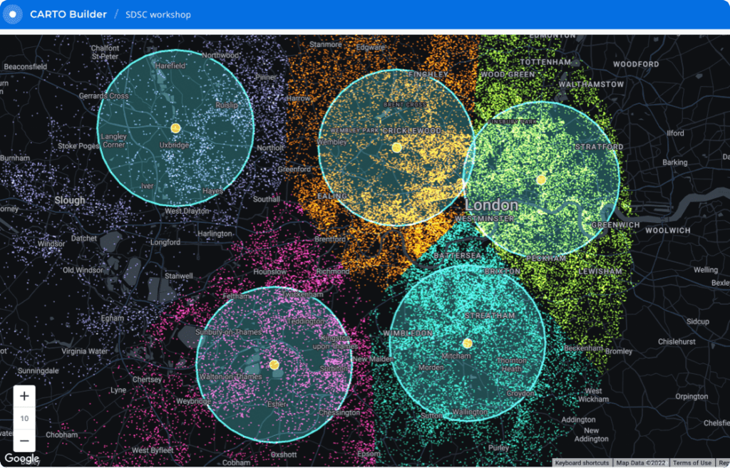
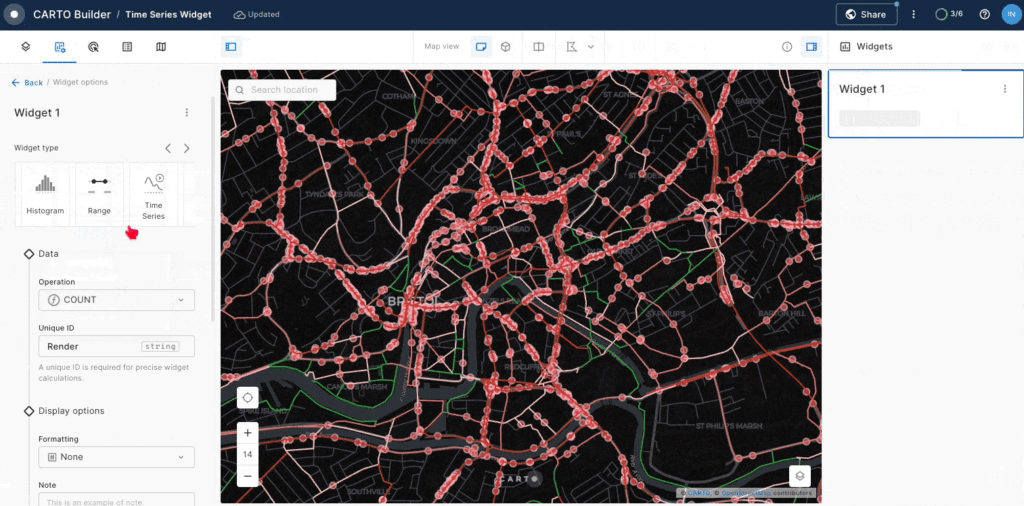
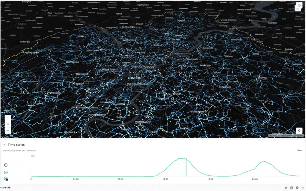
Carto focuses on location intelligence and emphasizes its ability to create impactful data visualizations. The platform simplifies the process of creating these visualizations by providing a library of potential options based on the input data. Carto also offers some unique data visualization choices, such as a hexagon grid for point layer interpolation. The map interface is widget-based, allowing users to select various data visualization widgets like charts, data tables, time charts, and key numbers to incorporate into their dashboards. Users can enhance all data visualizations and widgets with custom code and SQL queries for advanced customization.
CartoVista
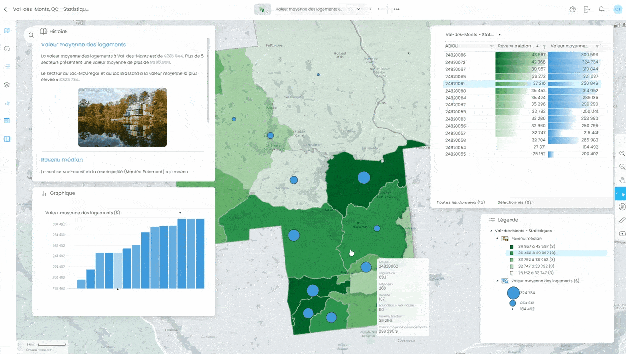
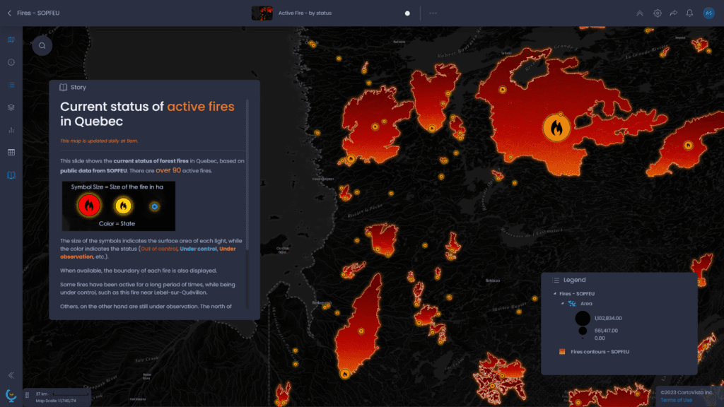
CartoVista offers a rich choice of map data visualizations for each of your data inputs. You can easily create multiple thematic analyses to enrich your map with multiple data representations. All are accessible without any coding required. The thematic analyses include dynamic charts, providing an additional layer of richness to your map. CartoVista further enhances customization with a library comprising over 1,500 map icons, with the flexibility to add your own icons. The platform’s base map selection also helps you customize your map design. Additionally, users have the convenience of fully customizing the interface by choosing the tools and panels visible on the map.
Storytelling and presentation
Carto
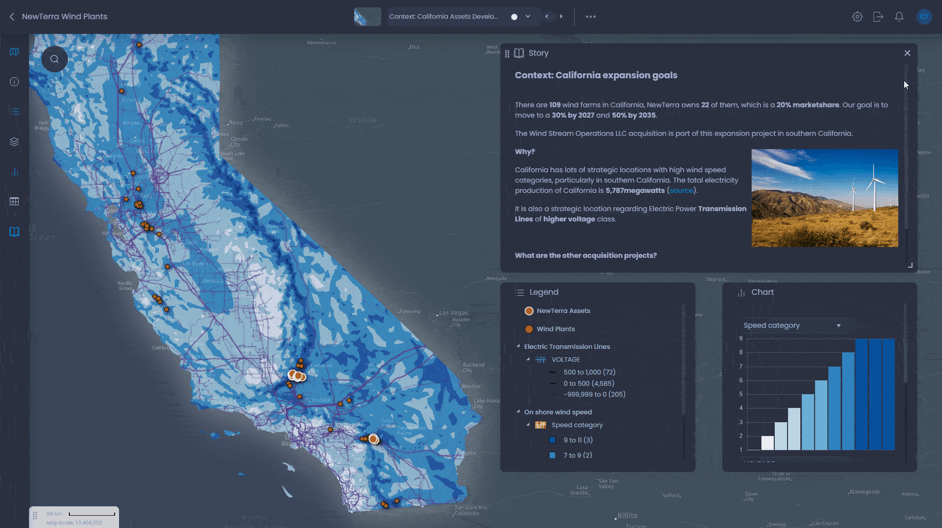
Carto does not offer the possibility of adding a story component to your map through text or images. However, it provides good support for integrating time-based data, offering nice data visualization options with time-based animation. This animation can serve as a good basis for a story on the evolution of the phenomenon represented by the data. The platform’s modern interface and dashboarding capabilities also make it suitable for conducting web presentations.
CartoVista
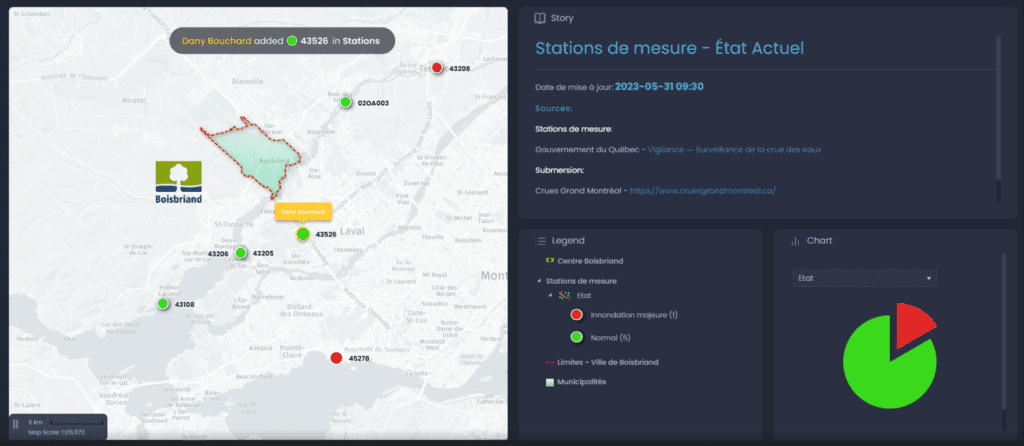
In contrast, CartoVista places a strong emphasis on web presentation and storytelling to further enrich data visualization. Users can seamlessly incorporate a story component, allowing them to input text and integrate images to complement the data visualization with contextual information and explanations. Users can create multiple slides to craft a web presentation where data and text are shown gradually. The text can also include links to map features to create dynamic storytelling. Throughout the presentation, users leverage the full interactivity of the map, charts, and table components to present their ideas to the audience effectively.
Collaboration and sharing
Carto
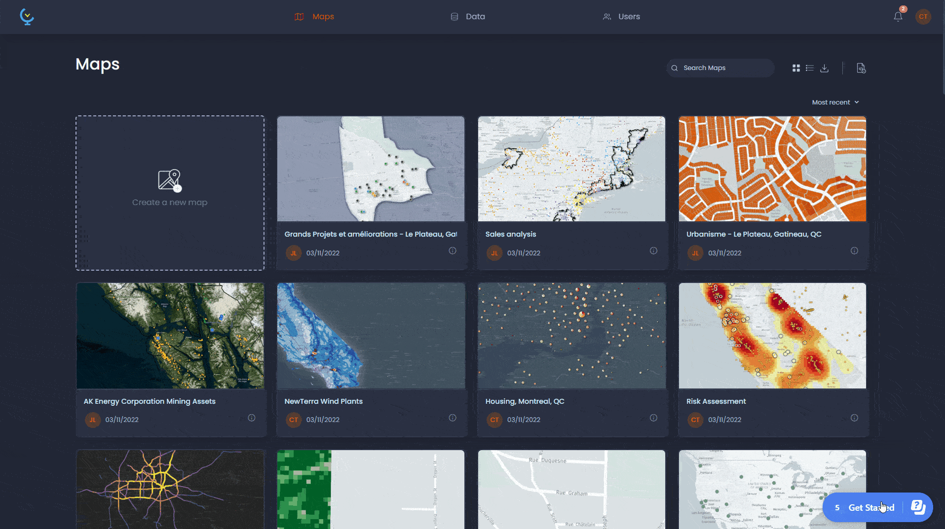
In Carto, each user has their own workspace with their maps and data. Users can belong to the same organization, where they have different roles (admin, editor, viewer) and can share their maps and data.
CartoVista
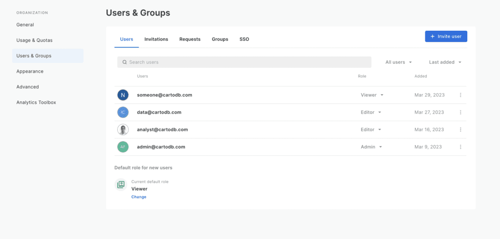
With CartoVista, all users of the same organization share the same workspace. Administrators can designate roles (admin, editor, viewer) for individual users and define specific permissions for each dataset and map. Once granted the appropriate permissions, users can edit data online to simplify data updates and improve the data quality directly online where all other users can view the most recent data. For improved collaboration, changes can be dynamically showcased in real-time, allowing visibility into who has edited specific features. To further streamline collaboration with other teams or organizations, the CartoVista REST API can be employed to maintain data synchronization with other sources efficiently.
Pricing
Carto
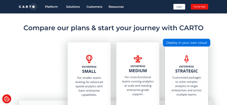
Carto is subscription-based, with different plans that include a fixed number of users, usage units and more or less features. To get you started, Carto offers a free trial. However, pricing information is not publicly available so you need to get in touch with the Carto staff to get a quote based on your needs. Similarly to Esri, Carto works with usage units, so it might be a bit more difficult to anticipate costs if you don’t have a clear idea of how many users, map visits or data analyses you’ll need.
CartoVista
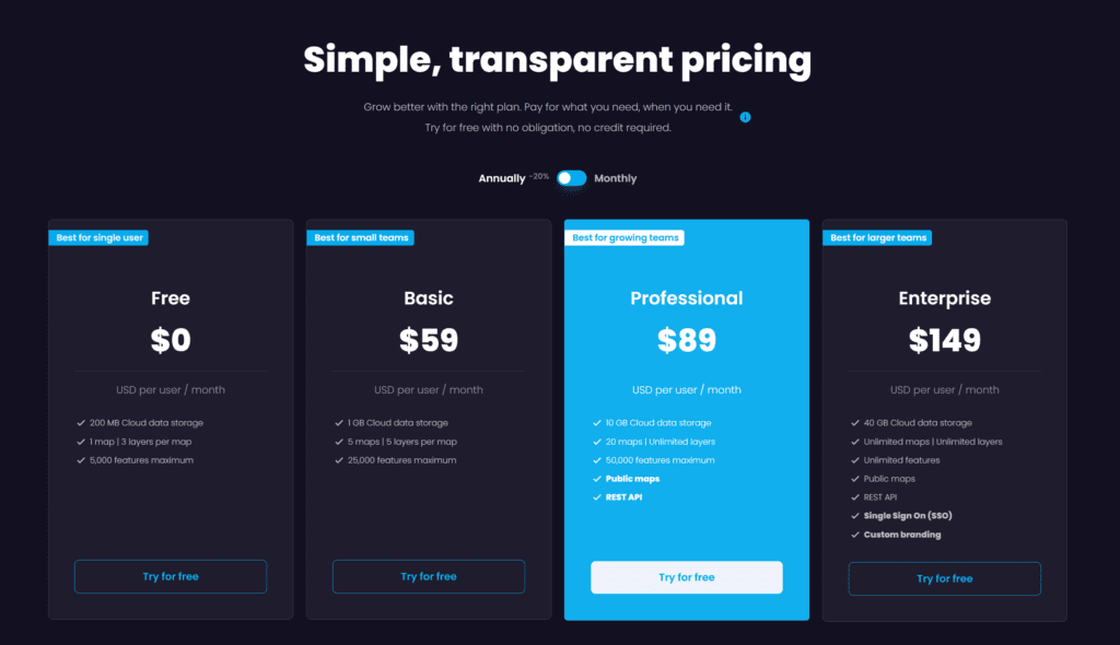
CartoVista offers a pricing structure based on the number of users, allowing organizations to choose a plan that fits their specific needs. With flexible pricing plans, it ensures that users will find options tailored to their requirements, providing a cost-effective solution for organizations of all sizes. To make an informed decision, CartoVista offers a free 14-day trial that allows users to explore the platform’s capabilities firsthand. This trial period enables potential customers to assess the value and suitability of CartoVista for their organization before making any commitments. Importantly, transparent pricing information is readily available on the website, and as the cost per user decreases with the number of users, users can obtain a precise quote and explore pricing easily during the trial period.
Verdict
Carto and CartoVista stand out as robust online mapping platforms, each catering to distinct preferences. For developers seeking a location intelligence solution, Carto can be an intriguing option. However, if you’re searching for a user-friendly platform that seamlessly integrates diverse data sources to facilitate informed decision-making and compelling storytelling, CartoVista emerges as the ideal choice.