
Transform Your Data into Engaging Maps
Create user-friendly maps with ease in the cloud. Boost your team's collaboration and decision-making.
14-day free trial No credit card required
Trusted by
Client logos: Hydro-Québec, Glencore, Brookfield, Desjardins, Promutuel Assurance, Intact Insurance, Bombardier Recreational Products (BRP), Aéroports de Montréal (ADM), Transcontinental Media, Consignaction, Ville de Gatineau, Communauté métropolitaine de Québec (CMQ), Ministère de l'Éducation du Québec, Travail, Emploi et Solidarité sociale Québec, MRC de Marguerite-D'Youville, MRC des Collines-de-l'Outaouais, City of St. Thomas, Ontario, Funecap Groupe, Transcollines, Pan American Energy, Bradesco, BluMetric Environmental, Université du Québec à Rimouski (UQAR), Government of Canada, Midcontinent Independent System Operator (MISO), Public Service of New Mexico (PNM), Southern Company, Tennessee Valley Authority (TVA), ISO New England, UniSource Energy Services (UES), Tucson Electric Power (TEP), New York Independent System Operator (NYISO), PowerSouth, CATALYST (a PCI Geomatics brand), Écoles catholiques Centre-Est, Assistel, Manage America, TB maestro, Accreditation Canada, Centre de Services Scolaire Des Portages-De-L'Outaouais


")

")


")


")


")

")


")


")

")

")


")


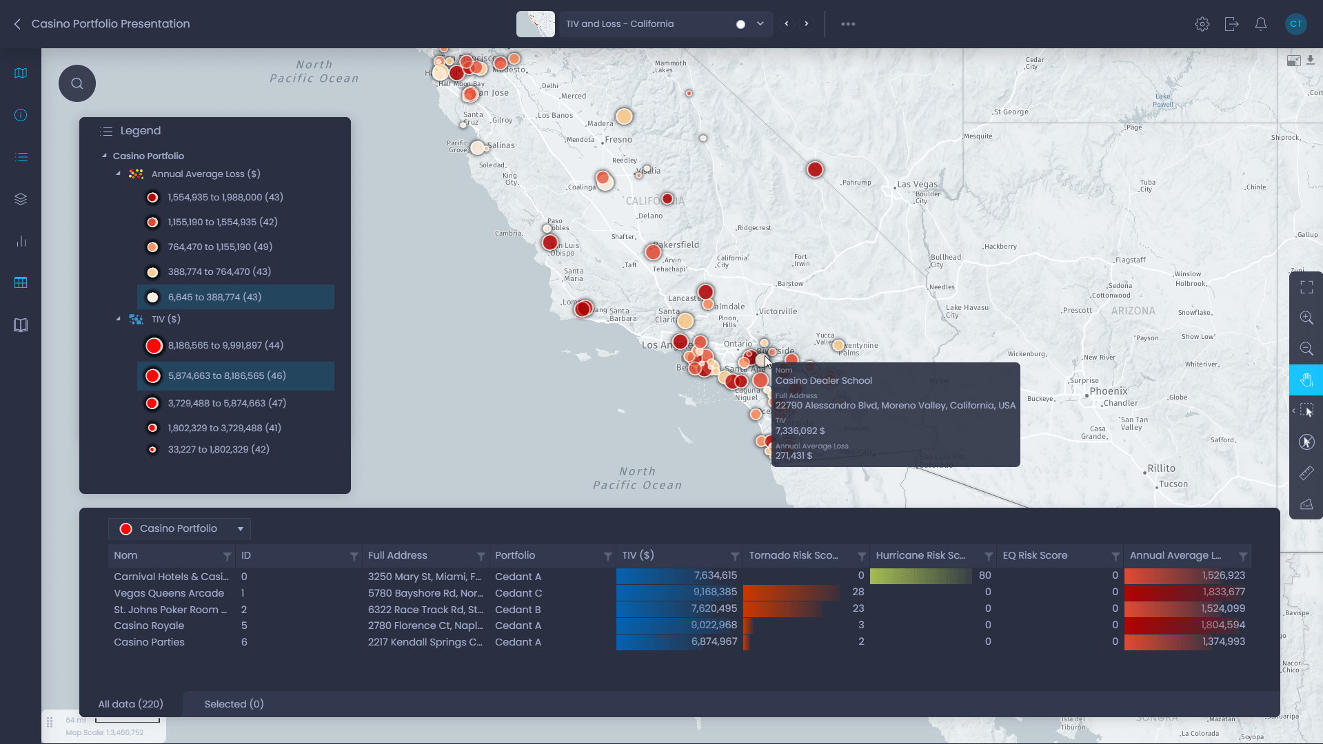
Analyze
Make Better Business Decisions with Data
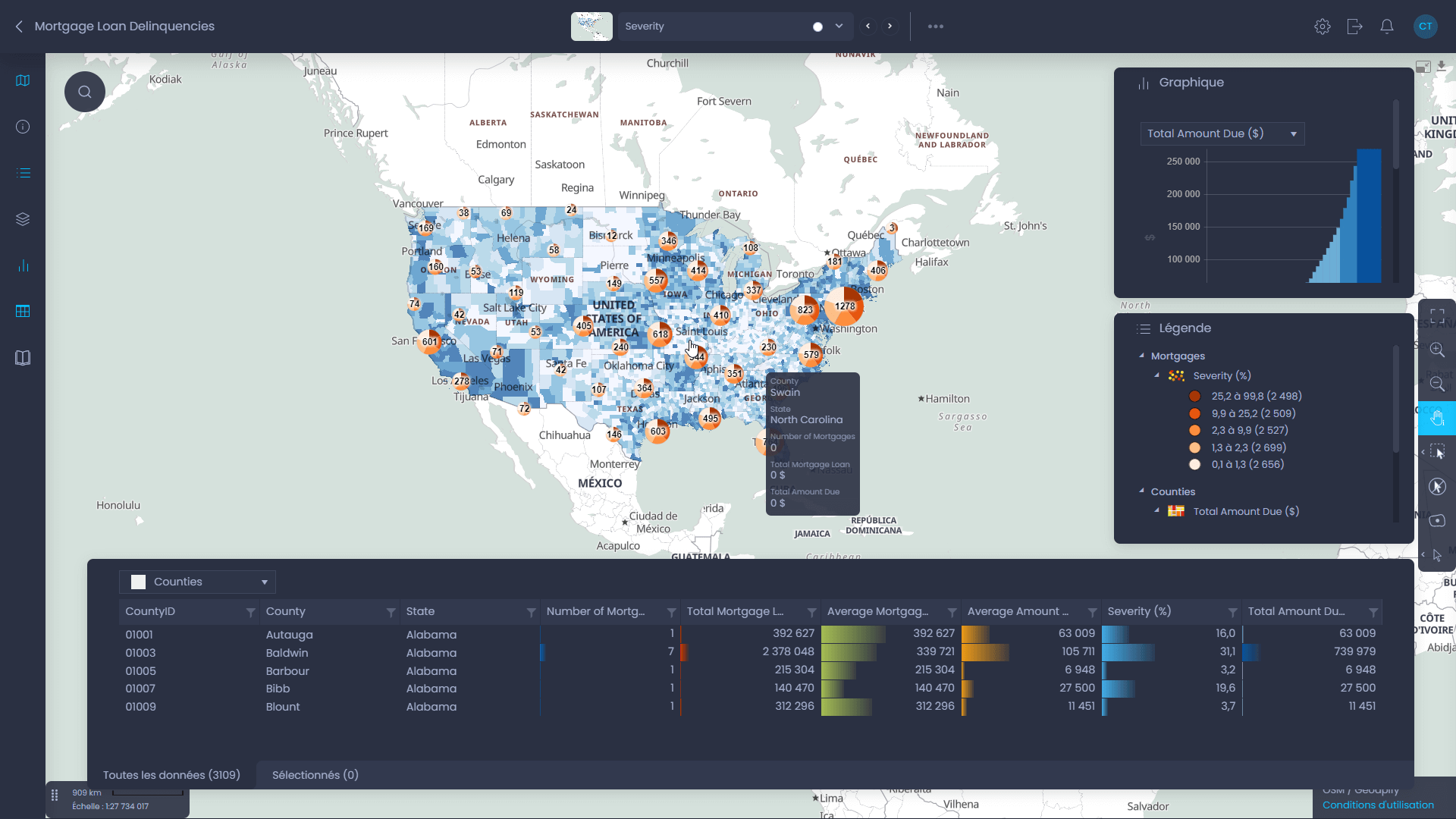
- Mix different kinds of information, from simple spreadsheets to more complex GIS data.
- Help your team make smart choices based on strategic data, keeping everyone informed and on the same page.
- Easily find answers to your business questions with simple analysis tools.


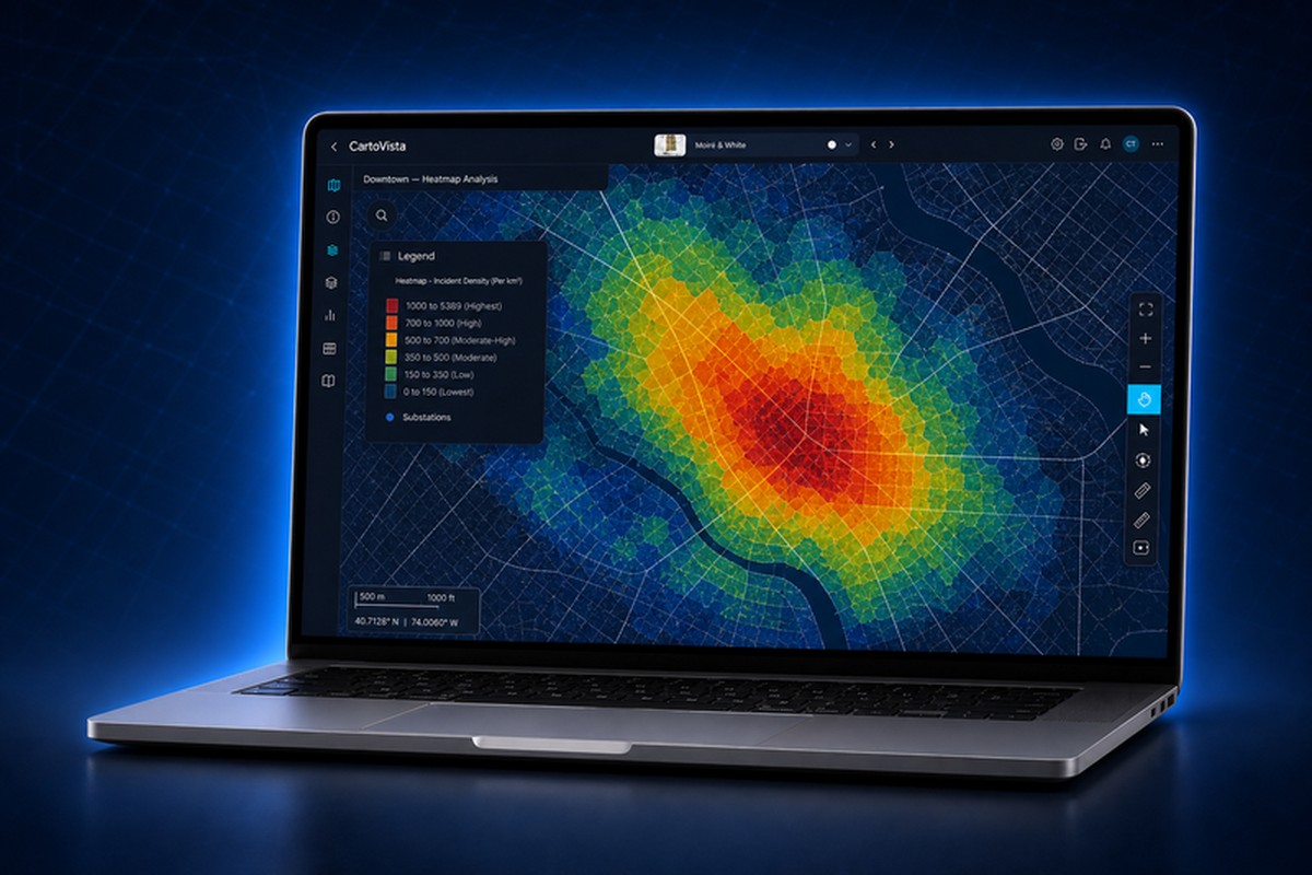
“We started looking for a way to implement the visual heat map display as required by FERC Order 2023. CartoVista's software and approach to our problem was by far the best that we saw. We have enjoyed working with CartoVista and their entire team.”


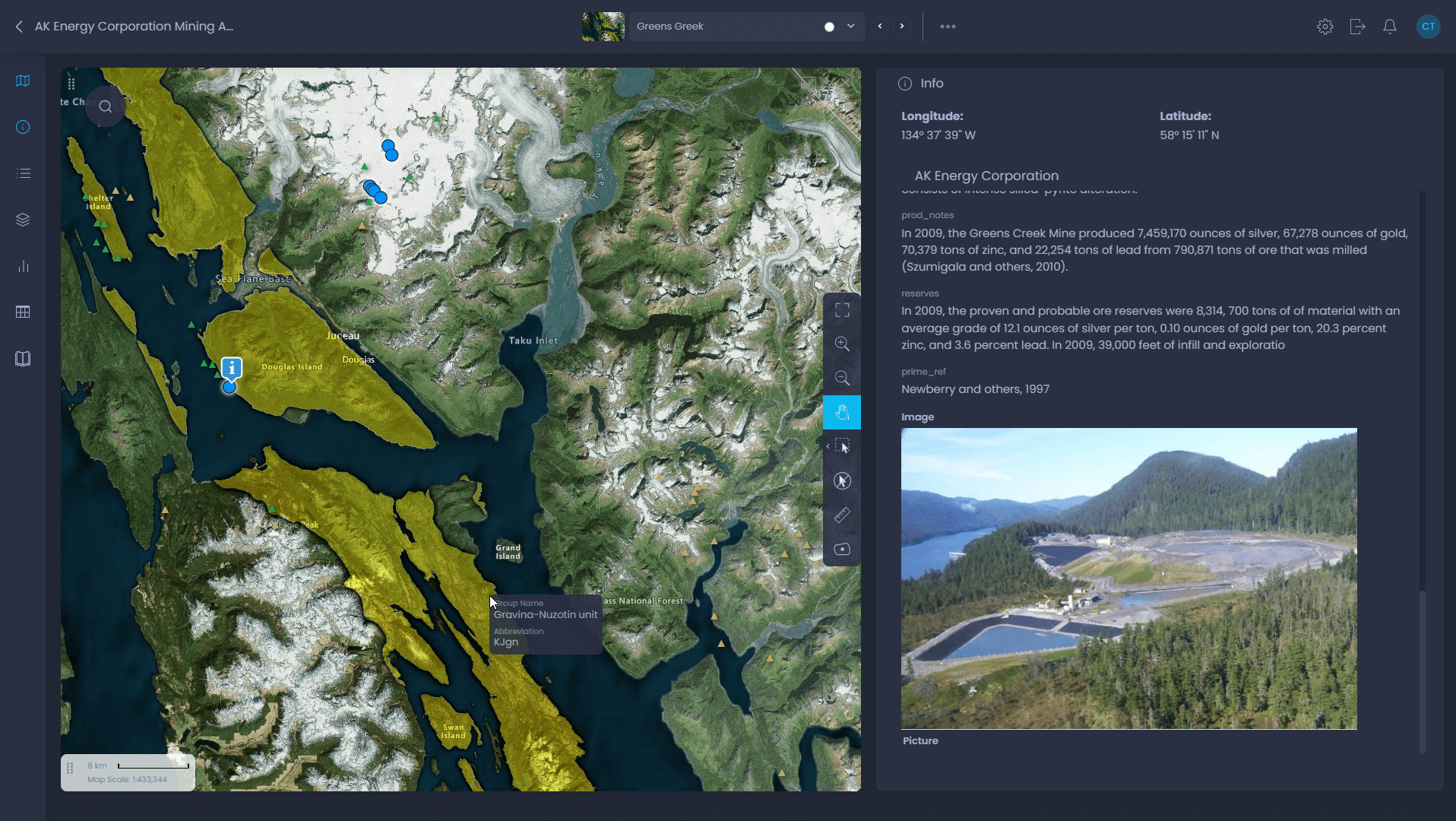
Communicate
Make Your Messages Stand Out
- Use maps and data without needing to be an expert in GIS or coding.
- Work as a team to create clear map presentations that everyone understands.
- Share your maps easily online or on your website, catching more attention.


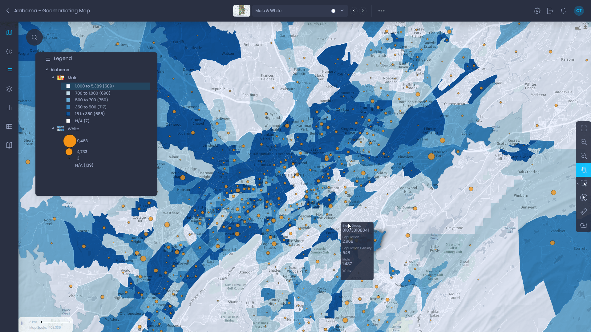
“Our clients absolutely love the geomarketing maps we produced with CartoVista. It offers a unique, user-friendly experience for our market analysis.”


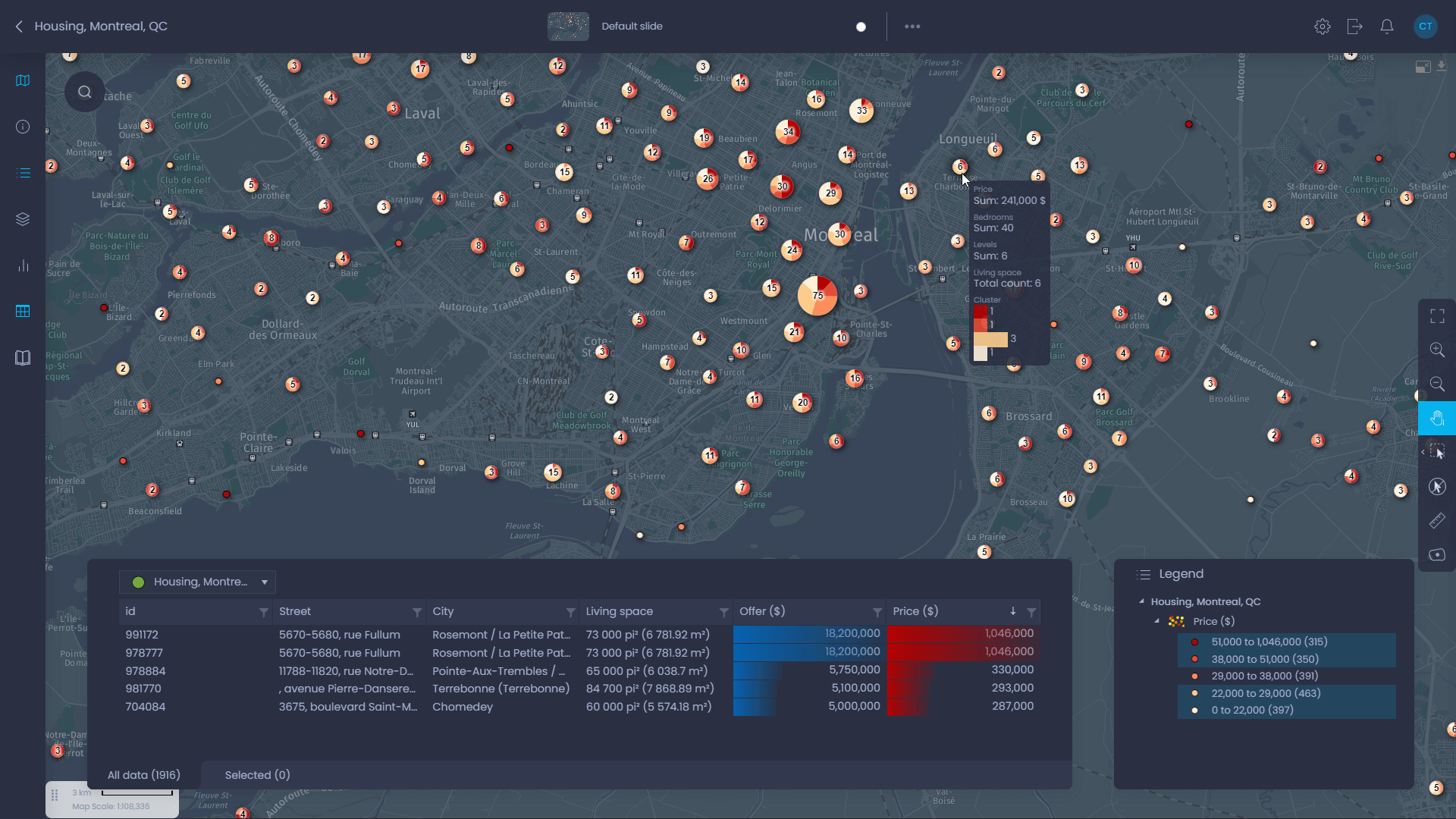
Save
Save Time and Cut Operational Costs
- Quickly turn your data into interactive maps with simple drag-and-drop, getting your projects off the ground fast.
- Keep your costs down with our straightforward and reasonable pricing.
- Kick off with minimal initial commitment and expand as your needs evolve.

")

“Adopting and implementing CartoVista was very quick, which greatly shortened our time to market with our new offering.”


From QGIS desktop to the cloud in a few clicks
Publish your QGIS projects as interactive, shareable web maps with the CartoVista plugin. In just a few clicks, move your maps from desktop to the cloud, preserve your styling, and make your data accessible to stakeholders in any browser.

CartoVista for Your Industry
Transform your data sharing and decision making.
City / Local Government
- Share key information between city employees and citizens
- Communicate visually and create outstanding map presentations
- Analyze and manage municipal data
Signature Works
CartoVista is revolutionizing how transmission providers communicate, cementing its status as the preferred mapping solution for transmission planning entities throughout the United States. Offering unmatched functionality and innovative features, we're at the forefront of industry advancements, specifically facilitating compliance with FERC Order 2023.
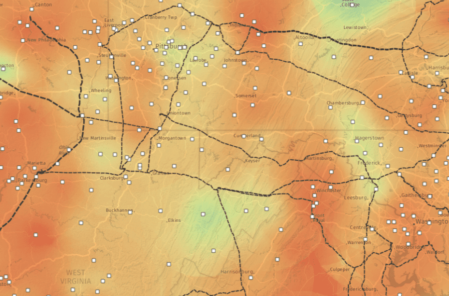
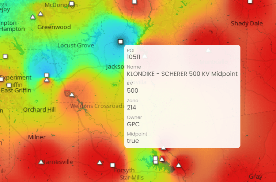
FERC Order 2023 Compliance & Public Heat Map Solutions
Learn more about FERC Order 2023 and how CartoVista is helping transmission providers develop compliant public-facing heat maps.
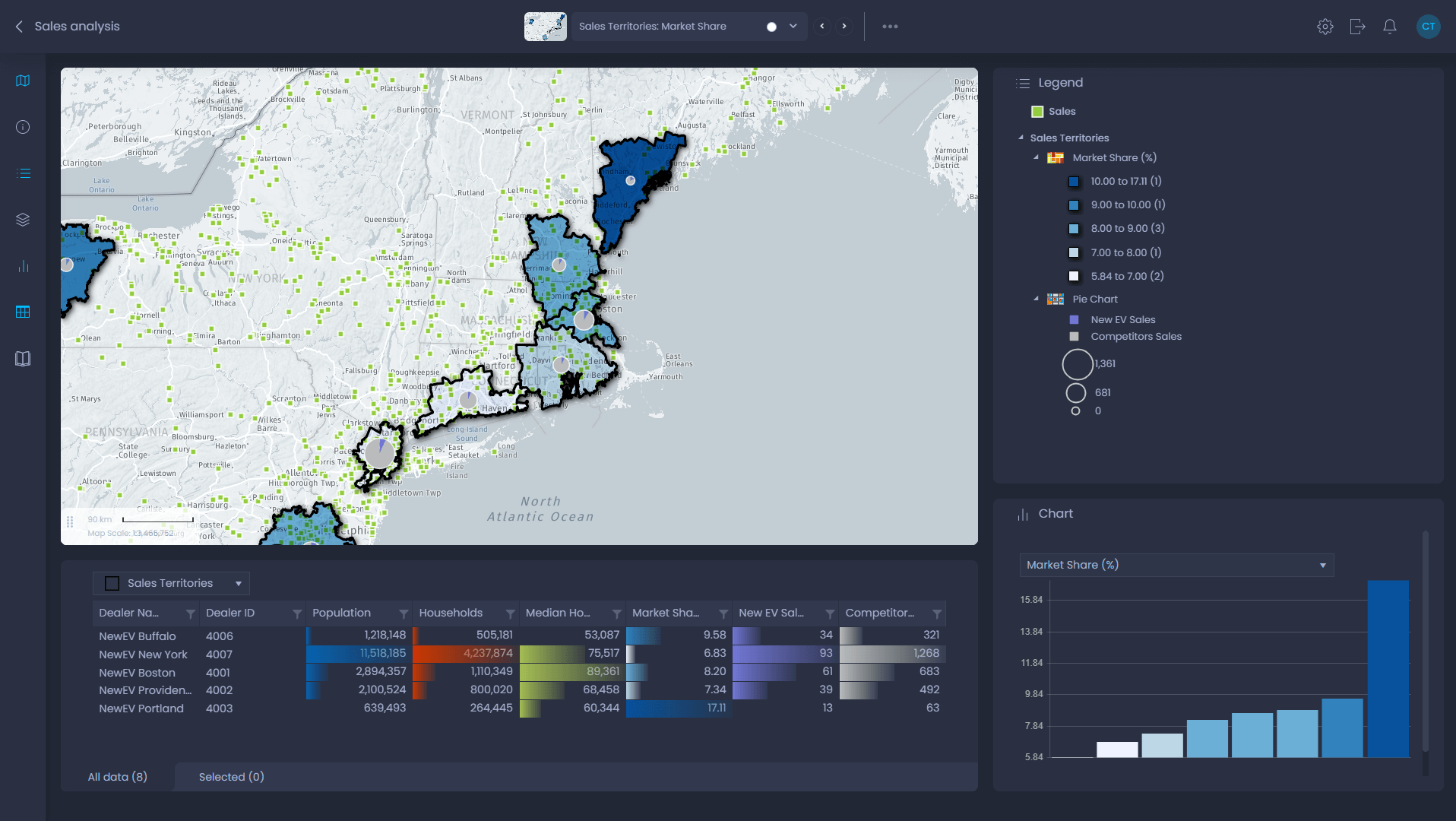
Revolutionizing Transmission Planning
CartoVista streamlines electric utility planning with cloud-based mapping, effortlessly integrating contextual data for deeper insights.
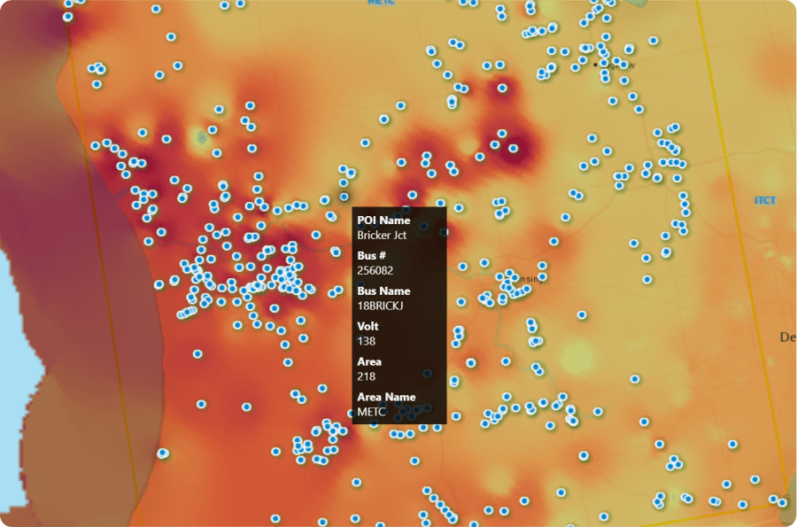
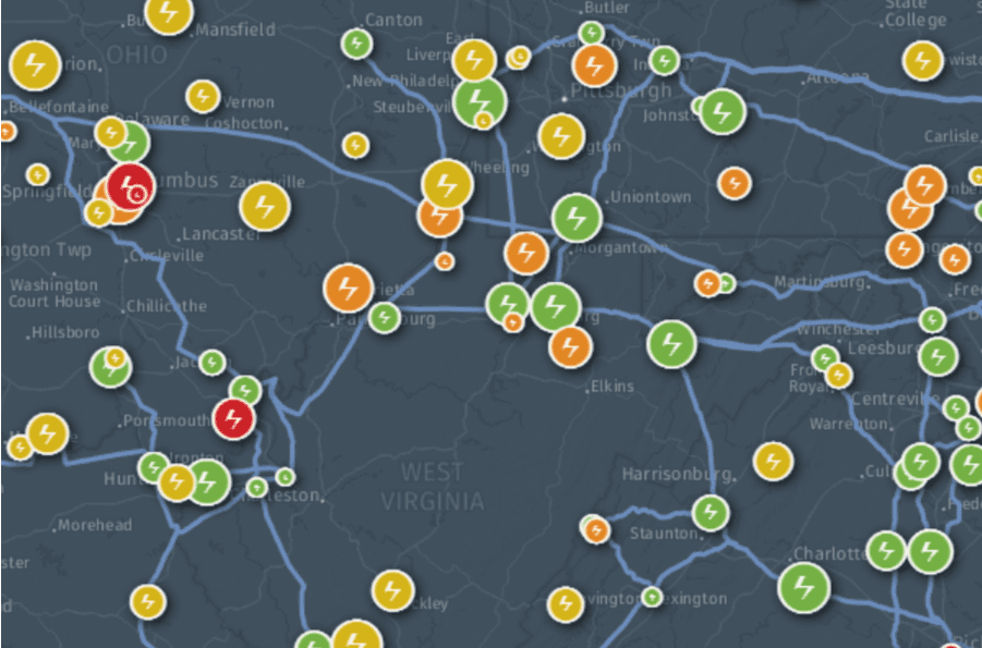
POI Analysis & Queue Maps @ MISO
Midcontinent Independent System Operator (MISO) collaborates with CartoVista to pioneer intuitive Point of Interconnection heat maps and queue maps.
Innovative Mapping Application for a Large Utility Company
One of the largest utility companies in the United States adopts CartoVista to launch a FERC Order 2023 compliant heat map project for enhanced connectivity insights.