We’re thrilled to announce the release of CartoVista 8.6, packed with features designed to elevate your online mapping experiences. Here’s a quick rundown of what’s new:
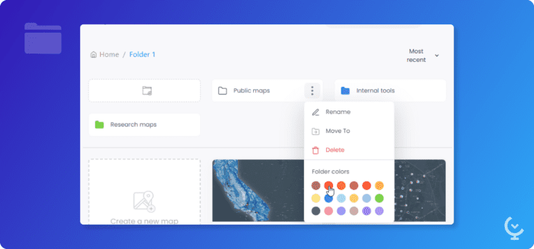
Folders
Better organize your maps and data with folders. Create and manage folders easily to create specific map and data galeries for all of your projects.
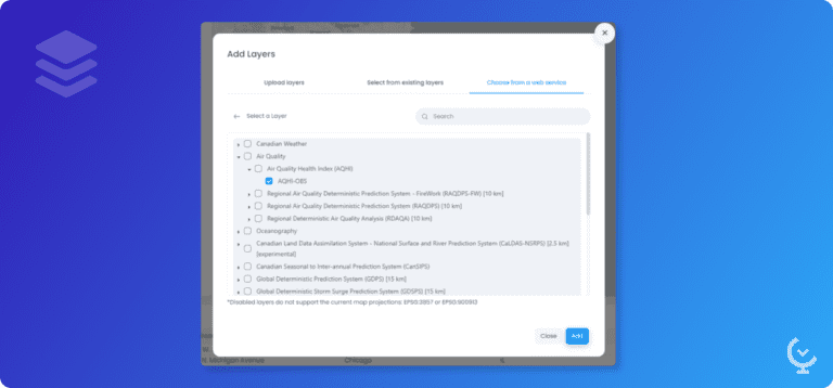
Integrate WMS and WMTS layers easily
We’ve enhanced the WMS and WMTS integration to allow you to integrate data using the Get Capabilities service. CartoVista will read the service and show you the list of available layers.
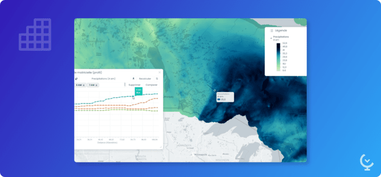
Grid layer profile comparison
Create a profile of your grid layer and compare it over time: select the data you want to compare from the list of available time data, and visualize the different profiles.
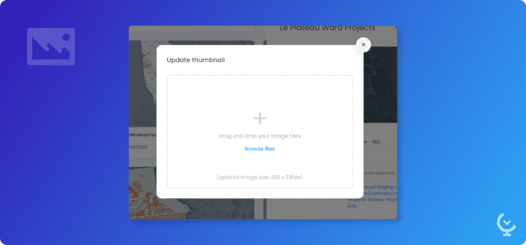
Custom map thumbnails
Map thumbnails are now customizable! Drag and drop your own image to make your Map Gallery look the way you want it to be.
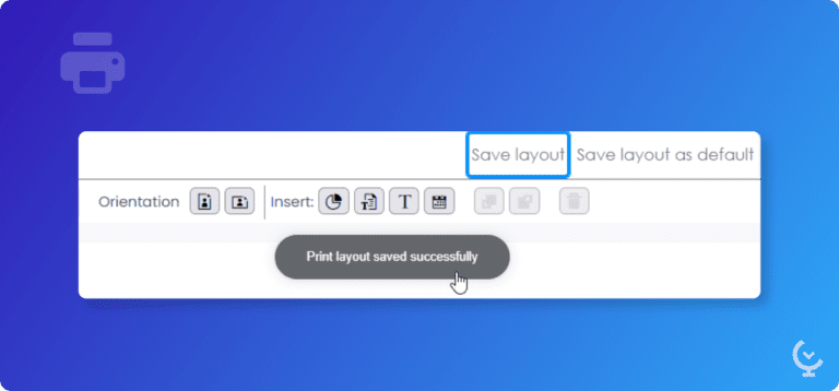
Custom print template
Print templates can now be saved to be applied to all of your maps. Integrate your workspace logo, add a disclaimer and source information to ensure the printed maps fit your branding.
Legend enhancement
Colors and symbols are merged for a simpler, easy-to-read legend. Thematic analysis are now easier to create!
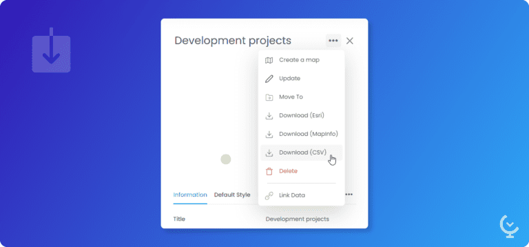
More download options
We’ve added new formats supported for download. You can now download your data in Esri Shapefile, MapInfo tab files, and CSV files (point layers only).
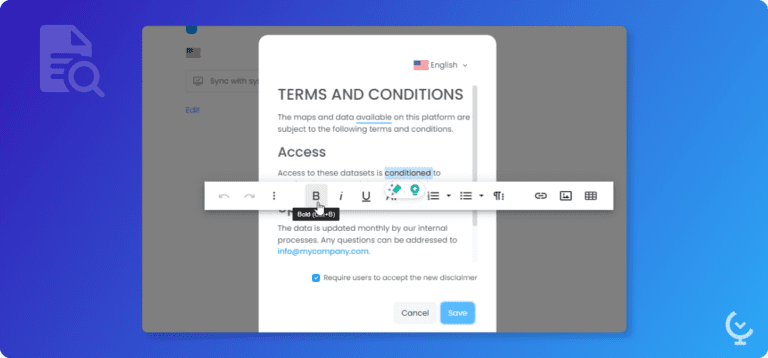
Custom disclaimer
Add a custom message when users log in to your workspace or visit a public map. This can be a good way to integrate your terms and conditions, explain how the data is collected and what it can be used for.
Start creating your first Story Map for free today!
The CartoVista platform unlocks the power of web mapping in the cloud:
• Design intuitive data visualizations and sophisticated presentations that puts YOUR data on a map.
• Create meaningful stories that will impress your stakeholders and make better business decisions.