Information

The Information panel is used to access to information on the map features that intersect with a specific point on the map and display the coordinates. This information is displayed once you click on the map with the Info tool from the Map Toolbar.
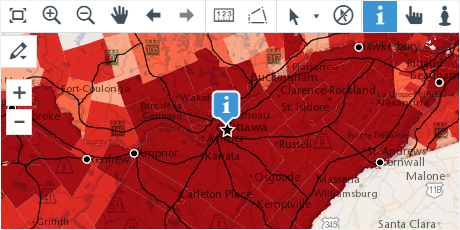
List of features
The info tool results are displayed as a list of items where each layer and individual map features are identified.
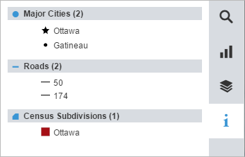
This panel provides the following information:
- The name of each layer is preceded by an icon identifying the layer geometry type (point, polyline, polygon) and is followed by the number of map features at this specific point on the map.
- An overview of the style is shown next to each map feature listed.
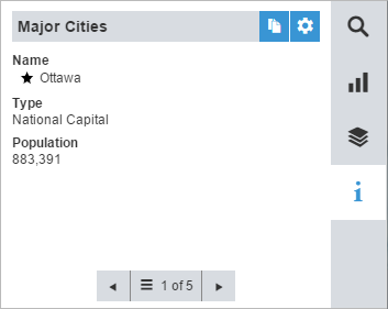
Description of each map feature
When clicking on one of the items listed, the information panel displays details about that specific map feature.
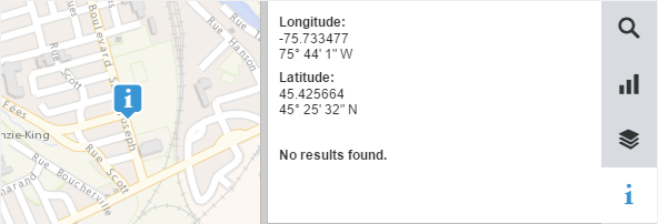
Coordinates
The coordinates can also be displayed in the information panel. The coordinates will be displayed wherever you click on the map, whether there is a map feature at that location or not.
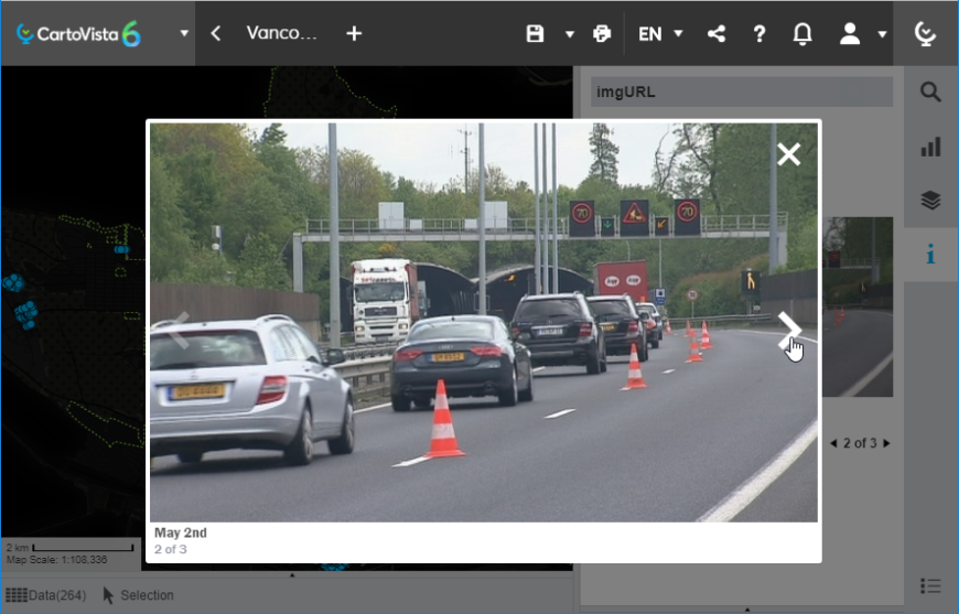
Image
When images are available in the map, they are displayed as a carousel in the information panel.
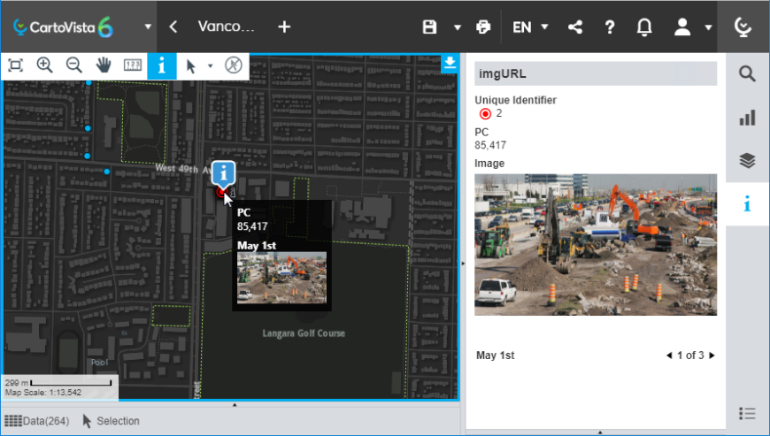
When you click on an image, a preview is displayed in the center of the map and allows you to navigate through the images available.
Options
The options available in this panel are:

|
Copy data to the clipboard. |

|
Access the Information Settings. |

|
View information for the previous feature. |

|
Return to the list of map features. In addition, this button shows the total number of map features overlapping this specific point in the map. |

|
View information for the next feature. |