For the map of June we wanted to show you one of the new features of CartoVista version 7.4. This feature was mentioned in this article. We have decided to focus on the analysis of temporal vector data. And since it’s summer and we are also concerned about the heat waves that are increasing around the world, we have chosen to illustrate our point with a “weather” map of the city of Ottawa, right next to our offices. To do so, we have studied the data from the city’s weather stations since 1900, showing some significant changes! This map is divided into three main themes:
- Total Precipitation
- Maximum and minimum temperatures
- Snowfall
Our new tool allows you to visualize the evolution of each station. Want to see information on precipitation in Canada’s federal capital? It’s easy. Select a weather station by clicking on it. In the bottom panel, click on the “Time” tool to view a yearly graph of precipitation trends. Click on a year in the bar graph to see monthly data. You can also click on a month to see the daily data.

Now you are interested in temperatures? You can select the temperature evolution in the map and the time graph like this.
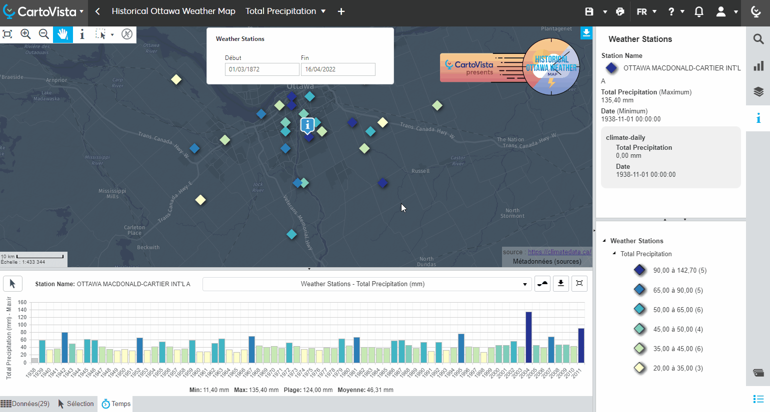
Finally, if you want to see the results for a specific time interval, you can use the interval selector in the calendar (or by typing the date yourself)

Don’t hesitate to contact us with any comments about this feature! In the meantime, the CartoVista team wishes you a great summer!