Login

Identify risks

Insurance

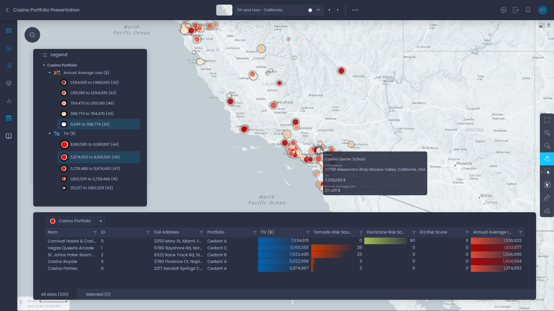
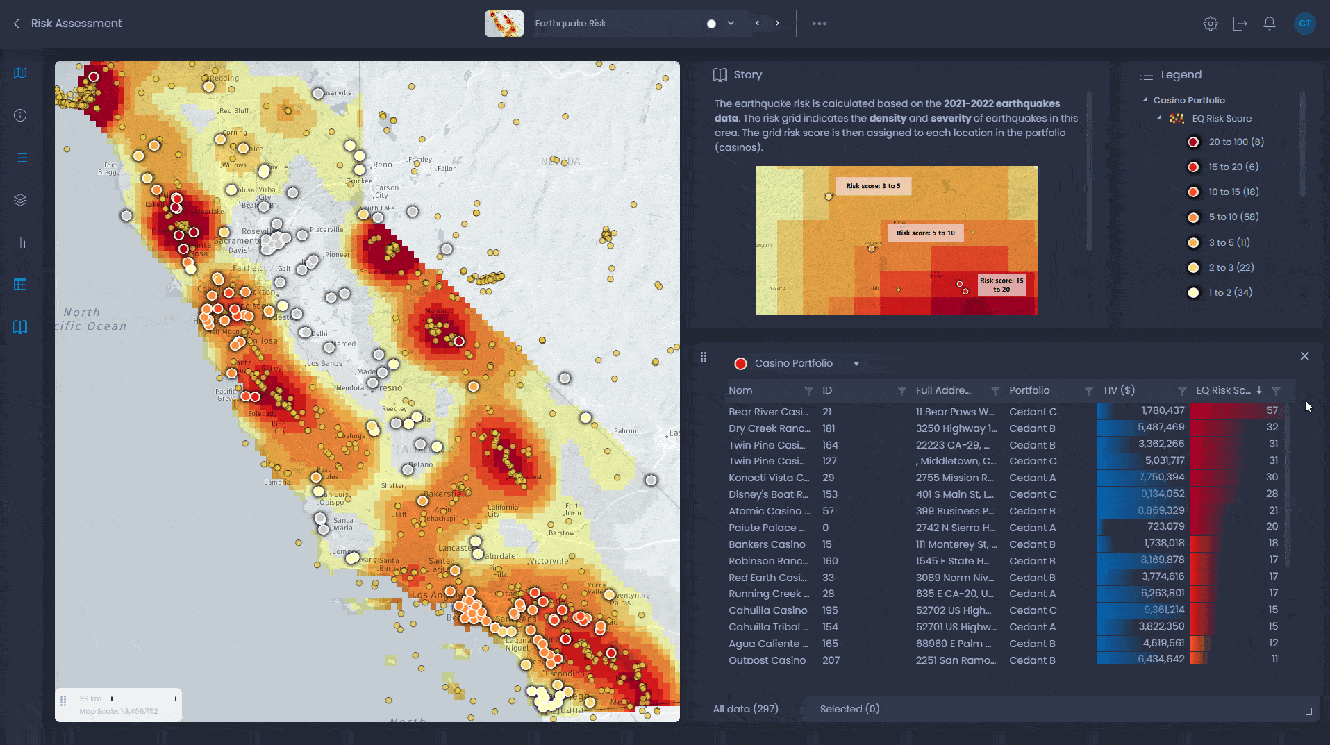
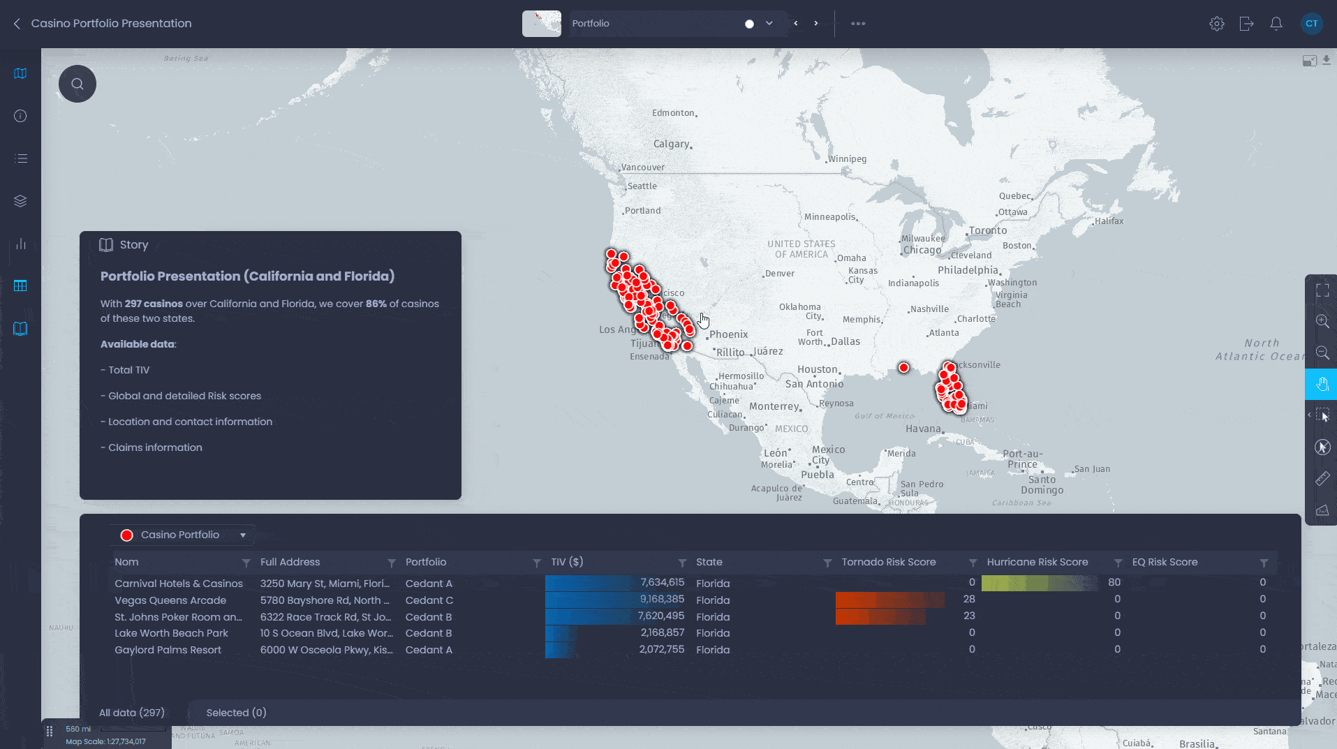
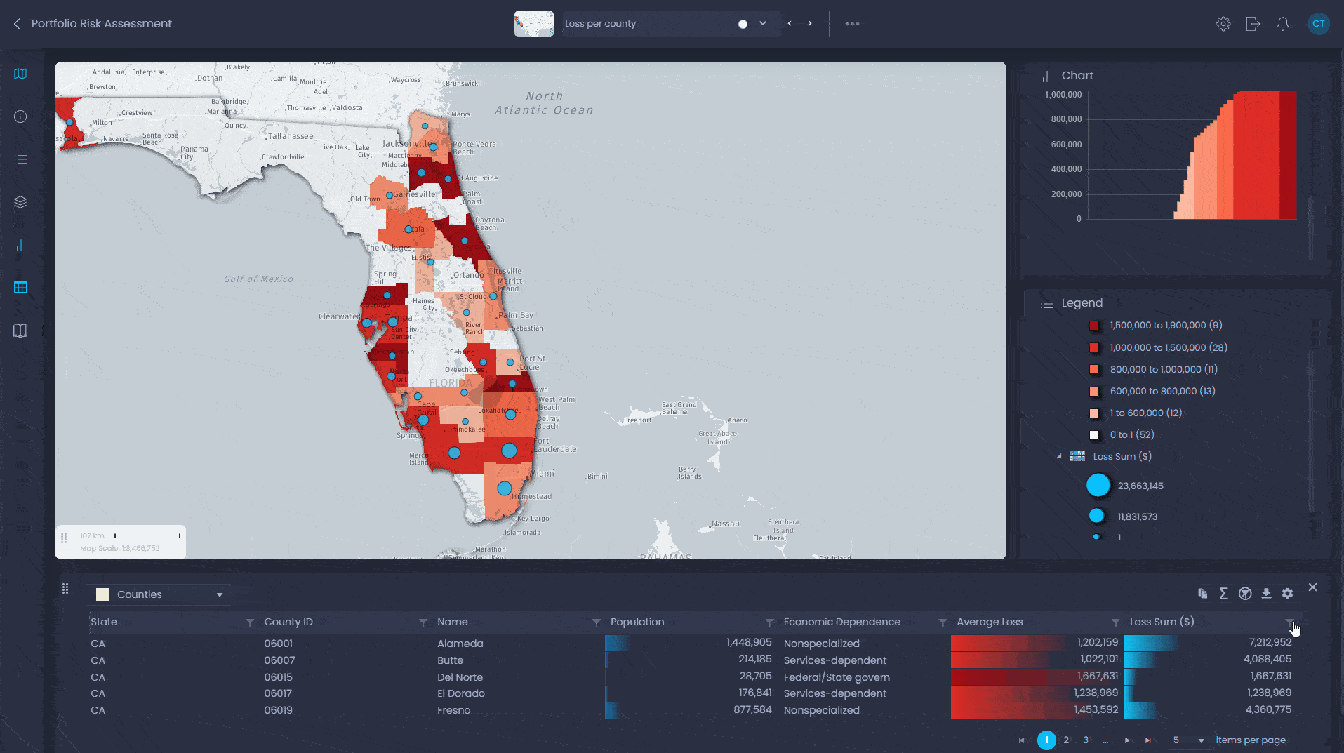
Underwriters and actuaries in the property and casualty insurance industry need to identify risk areas, improve the underwriting process, and improve analytical capabilities using geographic information. Risk management and access to data are at the heart of the actuarial problem. With CartoVista, overlaying risk areas—flood, hurricane tracks, earthquakes—with your own location data is simple.

CartoVista empowers you to

A businessman viewing chart on iPad

More than 75% of the financial services and insurance industry rate location intelligence as either very important or critical to their success”

Dresner Advisory Services 2018 Location Intelligence Markets Study

What you can do in CartoVista map interface

CartoVista in action for insurance

Underwriters

Data scientists

Data analysts

Business analysts

Actuaries

Catastrophe Risk Analysis

Integrate your own portfolio and risk/modeling data related to natural disasters (earthquakes, flooding, hurricanes, tornadoes, wildfire), for example—USGS, HU tracks, FEMA flood maps, RMS, AIR, Verisk.

Underwriters

Data scientists

Data analysts

Business analysts

Actuaries

Data Sharing

Share your corporate policy, claims and risk data in an centralized map portal accessible to everyone in the company

Underwriters

Data scientists

Data analysts

Actuaries

Underwriting

Perform analysis in the context of reinsurance—TIV for example—and catastrophic exposure.

cartovista logo

Try our professional plan for free

Ready to get started ?

The CartoVista platform unlocks the power of web mapping in the cloud:
• Design intuitive data visualizations and sophisticated presentations that puts YOUR data on a map.
• Create meaningful stories that will impress your stakeholders and make better business decisions.

Subscribe to our newsletter
Newsletter
Top